Table of Contents
*This post may contain affiliate links. As an Amazon Associate we earn from qualifying purchases.
Of all the easy yet rewarding hikes there are in the Los Angeles area, Sturtevant Falls holds the top spot.
While it does include a steep decline throughout the first half-mile, turning into a steep incline on the way back, the trail in full is only about 3.6 miles and is suitable for most people with little effort.
You’ll find Sturtevant Falls trail in Big Santa Anita Canyon, hidden within the San Gabriels Mountains, only about 12 minutes away from the 210 freeway.
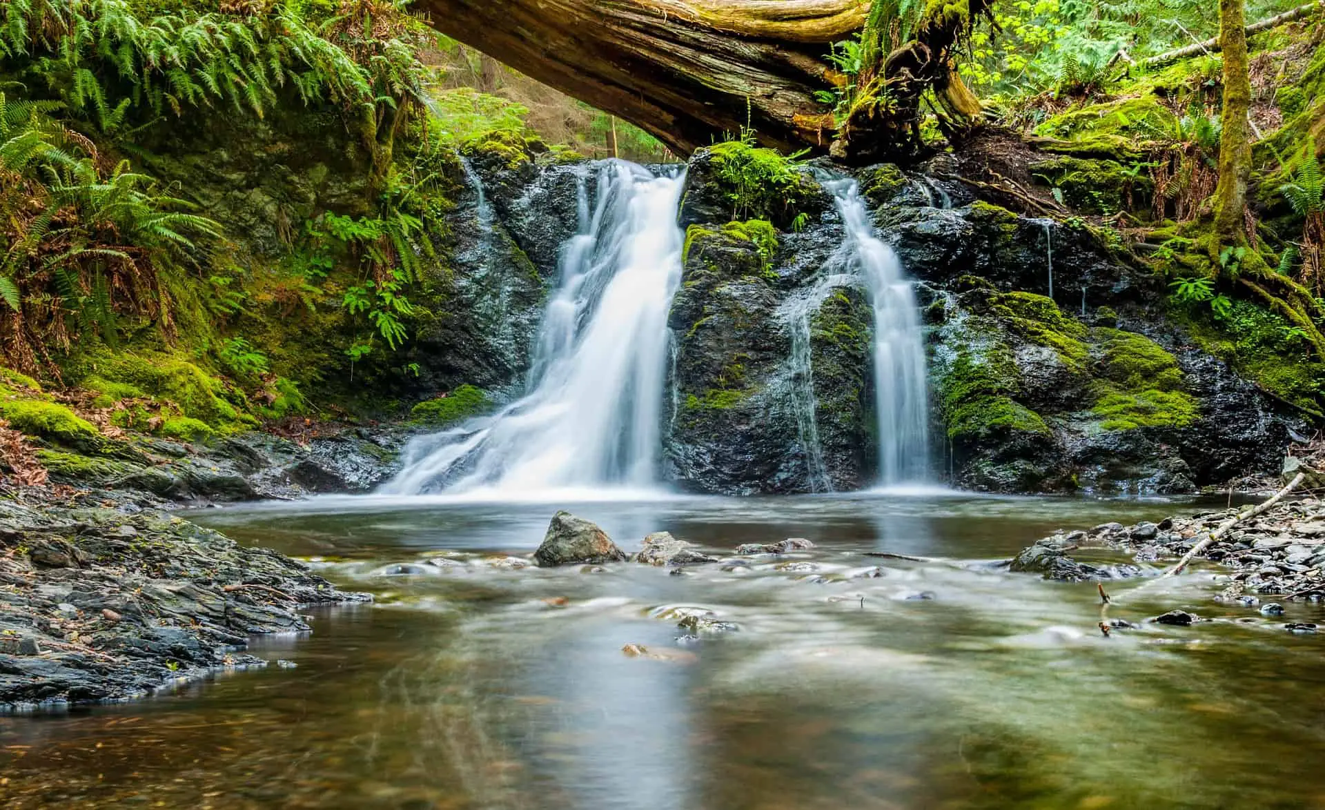
While the hike is short and sweet, the falls are actually some of the most stunning in Southern California. The algae and moss climbing up the cliff toward the running waters bring a lush and mystical appeal to the 50ft waterfall.
In this article, we’ll outline everything you need to know to experience the best of Sturtevant Falls.
Parking Near Sturtevant Falls

The most frustrating and complex issue you face during this hike is finding a parking spot. Since the area is extremely popular, the parking lot is almost always full.
During weekends, parking is sometimes backed up for over half a mile. So you’ll want to find a place to park and walk to the trailhead.
Take this into consideration during your hike preparations. Arrive at the trailhead early. If you can’t park at the main lot or at the $10 lot just past it, keep your Adventure Pass on display to park on the road.
You can pick up an Adventure Pass at a Big 5 or Sport Chalet sporting goods store. The price is $5 for a day or $30 for the year.
This hike provides a great escape from city life and offers a wonderful workout. You’ll want ample time to take in the gorgeous scenery and relax near the waterfalls.
Tips for Hiking Sturtevant Falls
This hike through the Angeles National Forest provides a chance to take in a true mountain hiking experience without driving for miles. While it becomes a bit crowded on weekends, the weekdays are usually more manageable.
Pack Appropriately
Make sure you wear quality hiking boots. Water-resistant shoes are a good idea since there are a few foot-dunks you’ll come across during the hike.
If you wish to make your hike a bit longer, head on over to Hermit Falls, another wonderful waterfall in the area.
Even though the hike is only 3 miles long, with an elevation of 646 feet, it’s important to come prepared with:
- Water
- Snacks
- Rain gear
- First-aid kit (can be kept in the car)
While the chances of anything happening on this easy and enjoyable hike are slim, it’s always good to come prepared.
Safety First
Always take the time to let someone know that you’ll be hiking and when they should expect to hear from you.
That way, if they don’t hear from you by a certain time and you’re not picking up your phone, they’ll be able to call the proper authorities.
[amazon box=”B00JG8KCLO” template=”table”]
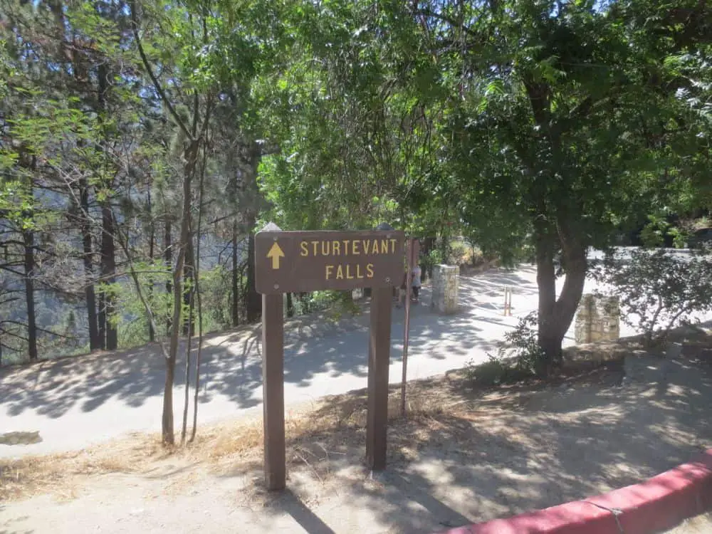
The Trailhead
The trail begins at the sign for Chantry Flats. As soon as you pass the gate, the trail declines. As we mentioned before, this is the only difficult part of the hike.
Once you make it to the bottom of this decline, you’ll find a small bridge you’ll need to cross over. There is a sign that indicates how far the waterfall is.
At this point, you’ll begin to see a few man-made waterfalls along the trail. While they’re not as magnificent as the natural one you’re heading for, they’re still pretty cool to see.
The trail is shaded the entire way from the bridge. It offers a peaceful and aesthetically gorgeous path following the stream.
Cabin Community
Follow the trail as it continues through the covered forest until you meet a small area of community houses. These cute, little 15 cabins are privately owned and used on a seasonal basis. This area is called Roberts Camp.
Continue along the path until you meet a water crossing. After the stream, continue up the trail for the final quarter of a mile. Before you know it, the waterfall greets you with all its splendor and beauty.
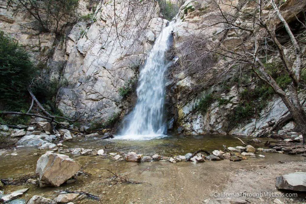
Waterfalls
The falls are close to 75 feet tall and are almost always being enjoyed by at last a few people at the base.
Once you’ve had your fill of the waterfalls and take all the potential Instagram pictures you can muster, head back the same way you came.
[amazon box=”B075DVXBPB” template=”table”]
After you make it back to the trailhead, sit back and recover from the half-mile uphill tread. Admire the last pack station in the San Gabriels, which was built in 1936. Grab a cold drink and take in the final moments of your outdoor adventure.
Alternative Adventures
If you’ve done this hike before and are craving more of the area, you can continue beyond Sturtevant Falls on Gabrielino Trail towards Spruce Grove Camp.
Sturtevant Falls can also be visited through the Santa Anita Canyon Loop, which is a wonderful and perfectly challenging 9.5-mile trek into the San Gabriel Mountains.
Final Thoughts: Sturtevant Falls

Sturtevant Falls is an excellent choice for a city getaway.
Like most waterfalls in the Southern California area, the popularity and splendor of the falls make them an experience to remember.
Though the hike may be crowded on weekends, it is still one for the books. It offers a decent amount of exercise, scenery, and rejuvenation for the body and mind. Plus, given its proximity to the city, it’s convenient.